Aneto, a guide on how NOT to climb it
- Siu Hoi Luk
- Aug 7, 2025
- 7 min read

The challenges and difficulties of hiking in the mountains differ by season. As someone from a tropical region, I knew that hiking in the rainy season made for a wetter, less enjoyable hike. But it wasn't until coming to Aneto that I realised that terrain, conditions, and difficulty can change so drastically depending on when you tackle the mountain. We attempted to hike Aneto in May 2025, expecting mostly rock and some snow and ice near the end. But I couldn't have been more wrong about it. For those also attempting Aneto in the spring season, this is a guide on what we did, what we did wrong, and how you can also go about planning your hike.
Contents
Introduction
Aneto is the highest mountain in the Pyrenees Alps, standing at 3404m. It is located near the border with France. Hiking it is usually done in the summer months when there is much less snow cover on the mountains. In the winter and spring months, practically the whole path is covered in snow, and it is usually done by ski touring, which saves a lot of time as you can ski down quickly. The amount of snow was something we severely underestimated and ended up falling short of just 200m from the summit. One of the highlights and the most exposed part of the hike is a narrow ridge called the Mahoma Pass, which one must traverse just before reaching the true summit. For reasons which will be explained later, we did not manage to reach this pass before we retreated back.
It is highly recommended to use crampons and an ice axe with you during the hike, even during summer months, as part of the trail crosses through a small section of glacier. In the winter conditions, it is a must as the path would be snow-covered from the very start of the trail.
There are two routes going up to the summit. Namely, the northern and southern routes. The northern route is the most commonly used. It involves starting at Besurta, going past Refugio Renclusa, passing by Portillón Superior and going up to the summit. This is usually done by staying a night at Refugio Renclusa and hiking up to the summit and back down the next day. Although the hike from Besurta to Renclusa is only about 1 hour, it can save a lot of time, and you can start later. This was the route that we took. The southern route involves going by Ibonet de Coronas to the summit.
Getting There
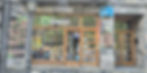
Regardless of which route you take, you will have to go past the town of Benasque. This is a small, nice town that usually sees visitors either during the summer months or in winter during the ski season. During our visit at the start of May, it was very empty and quiet. Nonetheless, there were still some shops open. It is about 4 hrs drive from Barcelona, where we came from. In the morning of the first day, we drove from Barcelona to Benasque to rent some equipment.
The town offers many outdoor shops, some with great gear discounts. There are also rental shops where you can rent skis, snowboards, crampons and ice axes. We did not own any crampons, hence we went to this shop called All Radical, in Google Maps, it is known as Guías de montaña - Roca y Agua. After asking around a few different shops, they are the only ones with rent out mountaineering boots. The other shops all rent out crampons and ice axes, but not the boots. However, the crampons we got were strap-ons and not semi-automatic like we expected.

We got our rental gear for I think a decent price of 91 EUR for 2 boots, 2 helmets, 2 crampons and 2 ice axes.
After getting our gear and going to the supermarket for snacks, we drove off to Besurta parking lot to begin our hike. The drive to Besurta from Benasque is only about 20+ minutes. If you are doing this hike in the summer, there are buses from Benasque to Besurta. During these months, the road is usually closed past Vado hospital. Some people drive to Vado hospital and take the bus to Besurta from there. From Besurta, the hike to Refugio Renclusa starts.

Refugio Renclusa
Renclusa is a Refugio about 1hr hike away from the parking spot. It offers food and beds to those who are hiking in the area. You can make a booking through their website here. The prices are also on their website.
Getting to the refugio was easy; a short 1-hour hike can get you there from the car park. However, we did not expect there to be so much snow on the way there. Most guides or blogs we saw showed that the snow only started a few hours in on the summit day. But those were probably for summer conditions. We were going at the end of May, and the path was still quite snowy. So much so that at the last 300m, the entire path was covered with snow. When we finally reached, we checked in and also paid for dinner and the next day's breakfast and packed lunch that we would bring with us.


Staying at a Refugio was a first for me. The only other comparable thing for me was the Himalayan teahouses in Nepal. This was a bit different. The space was quite well organised into living quarters, canteen and kitchen, and equipment area. And the biggest difference of all was the food! Although dinner was quite expensive (23 euros), it surprised me that the food was so good. We first had a soup with all kinds of beans in it. At first, I thought that this was it, because we're in the mountains and it's hard to get things here, and the beans do give loads of energy and protein. But then came the couscous with grilled chicken and chocolate mousse! I was totally surprised by the amount of food given. The taste was quite good too, given that we were up in the mountains. For Anny Ying, who was vegetarian, the chicken was replaced with two fried eggs.


After dinner, we went outside again while there was still some light to get our bearings on the way up for tomorrow's hike. We then quickly packed our bags and went to sleep.
The next morning, we woke at 3.30 am. We weren't fast hikers, and the snow beginning already at this point would make us even slower, so we knew that we definitely needed the extra time. Breakfast was prepared for us in advance. There was bread, biscuits, cake, juice and hot chocolate for us. They also prepared a lunch for us to take with us, it had cheese, a sandwich, an apple and a pack of isotonic drink powder.


Summit Attack!
Going to the summit was a daunting task! Especially since we were uncertain of the conditions, namely the snow at such an early point. Many other people were ski touring up the mountain and skiing back down, saving them a lot of time on the trip down. There were only about 4 other people who were hiking it with boots and crampons.

After packing our bags and food, we set off into the dark at 4 am and began the ascent! It was tough navigating the first part. The path is not clear near the beginning, and everything is covered in thick snow. We even went the wrong path once! Only when we saw other hikers go on another path did we realise that we had gone off course on a steeper route. At some point, when it got too steep, we put on our crampons. Looking back, we should have put them on at the start to save the trouble of having to put them on mid-hike.

After about 1.5 hours, the sun started to rise and we could see the path more clearly. Also, because other hikers passed us and we could just follow in their steps. It was just up and up all the way.

After a few hours, we reached a landmark called Portillón Superior. This was a narrow pass that cuts through a ridge. In the picture below, you can see the pass where people are moving down from. Because of the snow, the pass was extremely steep, about 50 degrees or more. If not for the ice axe and crampons that we had, it would have been impossible to cross safely. You can also see that below the pass, there is a cliff section that has only rocks; falling here would be a serious problem. Thankfully, we passed the section safely. I would imagine that crossing this would be much safer in summer without the slippery snow.

After Portillón Superior, the path was much easier. It was a gradual ascent for the next hour. But soon, a great step section awaited us.

Halfway up the ascent, we already had the feeling that our pace was too slow. But yet, we couldn't increase our pace because we were dead tired. We were just physically and experience-wise, NOT prepared for this hike in these conditions. After a total of 8 hours of hiking from the start, we decided to turn back, just 300m shy of the summit. The time was getting late; if we did not turn back now, we might have to hike back in the dark, which we did not want to do. Also, the weather seems to be turning bad. We made the tough but safer choice to turn back and head down the mountain.

Hiking down to the car took us another 7 hours. It would have been 6 hours, but we left some of our stuff back at the refugio and had to detour to get it back.

Final Thoughts
Looking back on our trip, it was a complete oversight on my part that the mountains would be completely covered in snow at this time of the year. I've also learnt that you could ski tour up snowy mountains and ski down much faster than hiking! So, learning to ski is going to be on my to-do list! For regular hikers with no/little experience with snow, crampons and ice axe techniques, I would strongly recommend not to do this hike during the winter or spring months. Leave it till the summer months for a much more doable hike. Even then, there will be some sections requiring crampons, and also there is the Mahoma Pass, which we did not get to experience. I will definitely come back to try this again as the views and terrain along the way were so beautiful!