Day 8: Cho La Pass
- Siu Hoi Luk
- Apr 25, 2024
- 5 min read
Updated: May 21, 2024

Elevation: 4695m to 5323m to 4834m
Total Ascent: 727m
Distance: 8.12km
Hiking duration: 8h 6min

This day was probably the toughest day for me personally, not just because of the long and steep climbs, but because of the exertion combined with the high altitude of Cho La Pass that triggered another bout of altitude sickness, my worst enemy.
After climbing Gokyo Ri without any problems with the altitude and acclimatizing for a full night at Thanak, I was pretty confident about Cho La Pass as well as it was only about 200m higher than Gokyo Ri. But I was proven wrong today.

Starting the day early at 7 am because we knew it was going to be a long way, we were all geared up in our "FINAL FORM" outfits as we thought it was going to be a cold day, we left the house looking and feeling like power rangers. the route for the first 1-2 hours was a slow gradual ascent. Not particularly steep. We were hiking on the banks of a stream, partially frozen by the cold at night. At first, the sun still hid behind the mountains which made it cold. As the sun peaked through, it started to get warmer and I removed my outer jacket to prevent sweating. We went up all the way to the start of the steam, then up a small hill where we got a first look at the ominous Cho La Pass.


we rested a short while at the top of the hill while contemplating the difficulty of the coming hike. From our viewpoint, it just looks like an almost vertical ascent up the face of the wall of black rocks. It got me kind of excited, but also worried that I'll get altitude sickness again. Going down the hill was really easy, we covered the downward portion in a short 10 minutes and then it was up and up all the way.

Once we started ascending again, we quickly slowed down in pace due to the fatigue. Seeing this, our guide gave us some of his stir-fried potatoes that he got from Thanak and shared it with us. It was quite tasty although it was cold. The spices gave us a feeling of warmth in the freezing weather and it gave us energy.

Up until this point, I was feeling pretty alright. No signs of altitude sickness so far. But it all changed in the upcoming parts. The next section was one of the steepest of the Gokyo EBC trek. Some online blogs write about this and even recommend that you do the Cho La pass anticlockwise to avoid climbing up this steep section as the altitude + intensity of it makes this path challenging and can trigger altitude sickness. However, because we were going to attempt Island Peak after visiting EBC, it would not make sense to go counterclockwise.

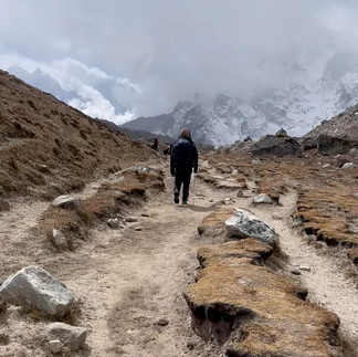
The trek goes gradually steeper and steeper. You can see from the Garmin tracker that there was an extremely steep section. about 50-60 degrees. Our pace dropped immensely in this section. we met only 1 other group of climbers coming down from the opposite direction and they cheered us on, saying that the end was not far off. Some sections have metal ropes secured to ensure safety as falling down was a high possibility if one was not careful.
About 10 minutes away from the summit, I started to feel very weak. Where normally, I would be able to run up such climbs, I was now moving one step every two seconds. I had not realised it yet at this point, But I was starting to feel the effects of altitude sickness. Perhaps I had pushed myself too far initially, thinking that once we got over the top, it would get better. But that plan backfired on me.

Once we reached the top, I began to realise that the altitude was getting to me. The familiar feeling of nauseousness together with a reluctance to move anywhere. Although we had just exerted ourselves greatly, I did not feel the urge to eat or sip on my water. But I knew I had to, so I drank some hot tea from my thermos.
The blanket of snow on the other side of the pass was beautiful, but sadly I did not have the energy to appreciate it then. All the pictures I had seen before showed this amazing snow-covered land and recommended micro spikes to cross it. Our experienced guide told us it wasn't needed, so we did not get them and we did just fine without it. The trail is well-walked upon and solid footing could be found.

While I was suffering and slowly treading across the ice, my friends were fully appreciating our first sight of snow on this trip. Coming from hot tropical Singapore, it was a very rare experience for us. Our guide warned us not to stray off the path though. This was because there could be streams flowing underneath the ice and if we were not careful, we could step into one of the streams and be soaked in icy waters.
The snowy path continued for about 30 minutes or so before it gradually faded away due to the drop in altitude. By this time, my nauseous feeling had grown and I felt like I was going to vomit at any time. I held it in. I knew that it was going to get better because we were descending down to about 4800m which I was already well acclimatized for.
We made a few steep declines and although I was unwell, we travelled fast as it was way less intensive to hike downwards instead of up. Soon, we reached back to an altitude of below 5000m. I still felt quite battered, the altitude usually takes a few hours to wear off on me. But I remembered thinking to myself, this scenery in front of me has to be one of the most amazing I've seen!

We LITERALLY hiking amongst giants! Although I was half defeated by altitude sickness. The landscape before me was unforgettable. We were in a huge valley, the trail leading through the centre. On our right was the towering Cholatse, staring us right in our faces. On our left was Lobuche, sandwiching us in the centre. And right in front of us, in the distance were a whole range of mighty mountains, Nuptse, Lohtse, Everest itself and Ama Dablam! Many more peaks surround us which I do not know the name of. It was a great pity that I could not fully appreciate the views before me. But I will be back again one day.

We continued through, the trail at this point was level and easier on us now. But that didn't make it easier. By the time we got to Dzong La, around 3 hours after crossing Cho La Pass, I was completely exhausted. We were further demoralised by the state of the accommodations there, which was below our expectations. Due to a lack of rooms, me and Matiens room were isolated from the main building, making it much colder than the rest. I remember after the hike, I just fell onto the bed in all my gear, defeated by the cold the intensity and the altitude.
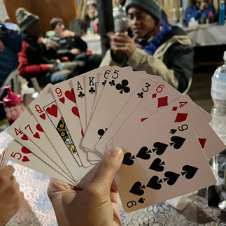
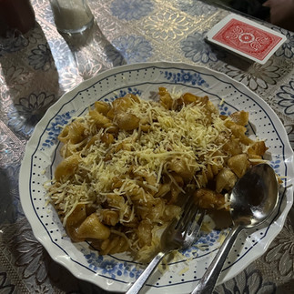
After resting for a few minutes, we pulled ourselves together and headed to the mess hall to regain some energy. The dining area was on par with the others and did not disappoint. After a hot meal and a few rounds of bridge, we had recuperated well and our morale was back up because we did it! We conquered Cho La Pass! The toughest objective on this trip less Island Peak!


Extra Photos!


Booking a Mount Rinjani tour is the first step for travelers who want to experience one of Indonesia’s most iconic volcano treks with professional guidance and organized itineraries.
Professional Hiking trails near me programs prioritize stable execution. Route coordination follows structured standards at Rinjani Trekking Center for maximum hiker safety.