Mount Apo 2954M via Santa Cruz Trail to Lake Vernado
- Siu Hoi Luk
- Jan 12, 2023
- 10 min read
Updated: Feb 12, 2023

Contents:
Mount Apo Intro
After almost 3 years of the Covid-19 pandemic, I finally had the chance to plan another multi-day trekking trip, this time, to the Philippines. Mount Apo (2954M), is the highest mountain in the Philippines. Located to the west of Davao city, it is a dormant stratovolcano. There is no historically known eruption of Mount Apo in the past. Mount Apo is incredibly beautiful, and the best season to hike it is from November to March when it is the driest. I would recommend anyone to give it a go and it's suitable even for beginner hikers as long as you have an average fitness level! A typical trek for this is 3D2N hike with the summit attack on day 2.

There are 3 main trails up to Mount Apo:
Santa Cruz Trail
Kidapawan Trail via Lake Venado
Magpet Trail via Lake Venado
Each trail has its own perks. Our plan was to take the traverse trail. Going up by Santa Cruz trail camping at Tinikaran campsite on day 1, and traversing to lake Venado camping by the lake on day 2, and exiting via Kidapawan. This would give us the best view of the sunrise when ascending the Boulder faces of the Santa Cruz trail and having the chance to experience the beautiful sunrise at lake Venado and also the Tausuvan waterfalls at the end of the Kidapawan trail. However, due to the rainy weather in the few weeks before our arrival, the Kidapawan trail was closed off to hikers exiting from there. Even Lake Venado was said to be fully flooded and unable to camp. However, we were extremely fortunate that the rain died down while we were there, just enough for us to make the traverse to camp at Lake Vernado. We then exited via an alternate Santa Cruz route which passes by a CENTURY OLD TREE!
Preparations
Guide

We engaged Mt Apo Adventures for this trek. Albert, the founder of the company, helped us to arrange everything from the transport to hiking permits porters and accommodations when we were out doing our RnR activities. He's a really nice fella who has been guiding people up Mt Apo for over 14 years! He was also very flexible when it came to changes or requests and even planned out our snorkelling and surfing lessons based on request. I Highly recommend looking for Albert and his team if you're thinking of hiking Apo. You'll see why in the main sections below.
What to Bring
For the trekking portion, all the trekking equipment is provided for AND carried by our porters. That includes tents, sleeping bags, tarps, ground sheets, camping tables and chairs, food during the trek and trekking poles. So that takes a huge load off our shoulders.
Clothing-wise, the temperature at the campsites are the coldest, I heard it can go down to 5 Celsius. But when we were there it was about 10 ish Celsius. So do bring along a warm down or fleece jacket. If you're particularly scared of the cold, you can also bring some heat packs to keep you warm at night.
A waterproof jacket/raincoat is also mandatory as is the case for all treks. There is always a chance of rain and one can get hypothermia if caught in the rain at those temperatures without a rain jacket.
Trekking shoes are very helpful. The trail is full of rocky, muddy, slipper, wet terrain. But my trekking shoe kept my toes pain-free and my feet dry throughout the whole journey.
Headlamps, a must-have for any trek as well. Our plan involved starting the trek at 4 am in the dark, hence headlamps are necessary. Even if you don't plan to trek at night, always have it with you as you never know if you'll encounter scenarios that may slow you down and force you to trek in the dark. It has happened to me more than once before.
Motivational food (Snacks). Do buy a bunch of snacks before the trek. Chocolates, sweets, fruits, biscuits etc. These will really keep you going when times are tough and you feel like giving up.
Day 0

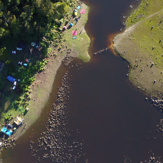
We took the 1030am flight from Singapore to Davao, flying Scoot. reached Davao airport at 2 pm and our guide Albert picked us up from the airport to our hotel about a 20 min drive away. There was nothing planned for this day, so we just went to a nearby supermarket to stock up on the snacks we would be needing for the trek ahead. Afterwards, we met back at the hotel at around 8 pm for a briefing on what to expect of the next few days. Albert informed us that due to the high rainfall the past few days, water levels at Venado Lake were much higher than usual and there is no space to camp beside the lake. We would need to camp in the forest beside the lake, or in the worst-case scenario, retreat back to our day 1 campsite and exit via the same route. A demoralising thought for sure as Lake Venado campsite was one of the highlights of the trek. But it is what it is, If nature doesn't allow it then there's no fighting against it.
Day 1 - Tinikaran Camp (6hr)

Waking up at 5 am, we loaded up our bag packs onto the van transport that was arranged for us. We drove 2 hrs to a town near the trailhead, Kapatagan. We had a quick breakfast at the town and packed our lunch. One of our guys, Kang Hao left his long pants at home by accident. Luckily the town had shops that sold clothing and equipment for trekkers attempting Mt Apo and he bought one at a cheap price which saved him from the chilly nights ahead. We packed our lunch at the same shop and continued another 30 min drive up the mountains to the trailhead.
The actual trek started at about 1100M elevation. The first part of the trek goes through some farmland on the fertile volcanic soil that surrounds Apo. This part was really enjoyable as the air was cool and the other was amazing farmland scenery everywhere you looked! This went on for about an hour until we went into dense jungle terrain.


The jungle portion lasted for about 4-5 hours with a lot of resting time in between. The hike is moderately steep and very dense in trees and vegetation. It was also quite muddy due to the rain before that. Nothing of much interest in this portion, it's very similar to the terrain you would expect in Malaysian jungles, boring and slow. We reached Tinikaran campsite a bit ahead of time at about 330pm. the campsite was at 2100M elevation and was chilly under the shade of trees. Our guides and porters reached ahead of us and helped to set up the tents and shelter for dinner. The campsite was a huge area with less dense trees spread about. I think it would be enough to fit maybe 70 or more people at once. There is even a toilet hut at the corner. Our team took one small area at the side, pictures do more justice than my words can, so here are some pics below :)


After enjoying our scrumptious meal and taking one last pee at the toilet, we all went to sleep at an early 7 pm. The sun here sets at around 530 pm and rises at 530 am as well so it was already completely dark by 7 pm.
Day 2 - Summit Attack (12hr)

Supposedly the longest trekking day, lasting 12 hrs of hiking, this day passed by surprisingly quickly. We got up at an early 4 am so that we can make the most of the limited sunrise at the boulder faces. We started hiking at 430. The first 2 hours or so were in the same kind of dense jungle terrain as the previous day. Hiking in the night, guided by the light of our headlamps is always a magical feeling. Having just woken up in the cold, I always feel like I'm in a dream-like state with only one purpose in mind, taking the next step. One step after another, 2 hours passed by in what seems to me now like a flash.
We soon reached the edge of the tree line where the vegetation is noticeably shorter and sparser. The rocky features become more prominent and by this time, the sun was rising halfway. the vegetation gradually lessened and we quickly reached the boulder faces after that! We hiked up a bit further up the boulder faces to a point where we had an excellent view of the town surrounding Apo and the seas beyond and had breakfast there!


Breakfast that day was luncheon meat with rice and a hard-boiled egg that our porters had cooked for us that morning. After about half an hour, we set off again. The summit was still far away, about 5 more hours. Although the trek was steep, non of us ever felt tired or bored of it. The great scenery behind us and the majestic mountain in front of us kept us in awe and wanting to keep pushing forward. Those 5 hours of trekking felt like a short 2-hour hike.

Along the way, there were also shrubs that had berries on them. Once I confirmed with the guide that these were safe to eat, we tried them. The dark blue ones were sweet and the red ones were sour. They kinda tasted and looked like blueberries.

The trek became harder as we neared the summit. Some of our members had a hard time breathing due to the sulfurous fumes coming from the dormant volcano. But we pushed through regardless.
After a steep ascent, we reached the old caldera. Usually, this large emerald lake is just green and mossy. But now it is filled with water due to rain in the past few months. it was quite beautiful as the water is crystal clear with a green tint from the moss below. at this point, we were only about 15 minutes from the summit.

We took another 5 minutes to catch our breaths, then headed for the summit! Albert told us that there are actually 7 high points on this mountain and we would be visiting 3 of them. the second one was the highest and thus it's the true summit.
Summit 1


Summit 2
We visited the first 2 peaks before lunch. Strangely, the feeling of elation we got from reaching the summits was not what we expected. Although the view from the peaks was nothing short of incredible, as seen from the images, the trek for the past 5 hours already had us marvelling at our surroundings. It truly is the journey, rather than the destination, here that made it all worth it. Here are some more photographs of us at the summit.


After spending some time taking in the sceneries, we hiked down a bit to a nice spot about 10 minutes from the summit to have our lunch. There, our lovely guides and porters cooked for us another delicious meal!


we rested for about 30 minutes here, but we couldn't stay here too long as we still had a long way to the next campsite. After lunch, we went and visited the last peak of the day.


At this time, it was getting late, we had 4 hours of daylight left to get to our 2nd campsite at Lake Vernado. At the top of the 3rd peak, we could clearly see Lake Vernado and to our delight, the water had receded just enough for us to camp by the lake! Motivated by this great news, we quickly set off for the last stretch of hiking. The way down was much easier than going up. we took about 3hrs in total to hike down to the lake, earlier than expected.
When we reached, it was about 4 pm and the tents had already been set up for us by our porters. Tired from the long trek throughout the day, we settled into our tents and rested. The view of the mountain from our campsite was magnificent! We could see the mountain in its full grandeur right in front of us and also reflected on the surface of the lake. Knowing that we had just conquered it gave us a sense of achievement and made the moment even more beautiful than can be shown in pictures. to get to the campsite, w had to cross a really sketchy makeshift bridge made from pieces of wood tied together. You can see in the photos below, luckily all of us made it through without falling into the waters!


We had a great dinner there that night and rested early. The temperature by the lake was colder than the previous day's campsite, reaching around 9 Celsius. we also took some night shots like the video below!
Day 3 - Century Old Tree (8hr)
On the last day of the trek, we got up slightly later at around 7 am. The sun was already up fully and what a beautiful sight it was. We had a good breakfast at the campsite and set off around 8 am. the trek down was much more relaxed compared to the day before. mostly gradual downhill in foresty terrain. As the exit at Kidapawan side (where people usually exit by) was closed, we made a round back to our initial starting point which was Santa Cruz. the hike was long-distance wise, but we covered it very quickly as there was little uphills. Along the way, we stopped for lunch at a huge tree that apparently has been there for over a century!


After about 7 hours, we finally emerged from the forest and into the farms and villages that w saw on the first day! 2 more hours of hiking brought us to the start trailhead where our van transport picked us up.


The ride back was about 3 hrs long and by the time we reached back to our accommodations, it was already dark. We celebrated by having a sushi feast! Everyone was dead tired by now and we all went to sleep early for the snorkelling activity the next day.


Day 4 - Snorkeling and Surfing!
Although the hike was over, we still got up early at 7 am to make full use of the day! the sun was already up fully and we boarded our van to make our way to the famous Pujada Bay!


The waters were crystal clear and the sun made the colours of the sea vibrant and beautiful! There was a lot of coral, some were dead, and some were alive. Sadly w did not get to see any sea turtles or big fish around. But there were plenty of small fish like the sergeant fish, parrot fish and other small fish species. we Also saw these large starfishes, which I later found out to be chocolate chip starfish! Here are some pictures of us being mermaids below.


After that, we went to Mayo Bay to do some surfin!


And then we ended off the trip at a local disco bar!

And of course, we had to try the famous BALUT. Which is basically, fertilized developing duck egg. They had the just fertilized, 16 day and 18 day options. We got the 18 days.
Last Thoughts
And so our short 6 days have ended. Such a great experience, to be able to immerse in nature in such a way. I would definitely recommend anyone trying to do hiking to attempt mount Apo! Next up in 2023, I'm going for Mount Rinjani in June as a warm-up for my most ambitious climb yet near the year's end! See yall!
